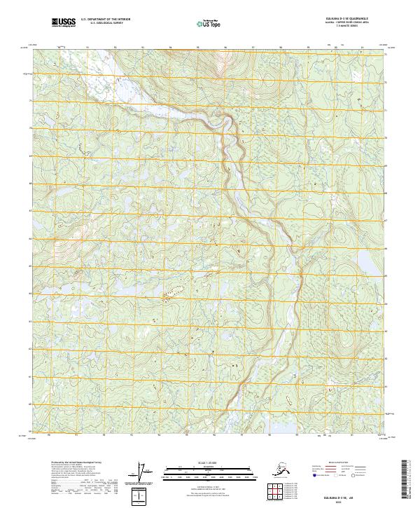
2023 Map of Gulkana D-3 SE
USGS Topo · Published 2023About this map
The Gakona River winds through this interior landscape, a high-latitude region within the Copper River Census Area. This part of Alaska is characterized by a complex network of wetlands and seasonal water bodies that surround the main river channel and its tributaries. To the north and east, Excelsior Creek feeds into the drainage system, while Otter Creek meanders through the central terrain. The land is organized by the Public Land Survey System, with boundaries such as t12n r1e and t13n r2e delineating the remote wilderness. This map provides a clear picture of the natural hydrography and elevation contours, illustrating how the glacial or snowmelt-fed waters of the Gakona River shape the surrounding alluvial flats and low-lying topography.
Find a feature on this map
9 named features on this map. Tap any name to fly to it.
Don’t see what you’re looking for? This feature index may not catch every label — zoom into the map to look around manually.
Map Details
Editions of this 2023 Gulkana D-3 SE Map
This is the sole edition of this map. No revisions or reprints were ever made.
Other maps of this area

1949 · Gulkana C-2
USGS Topo · 1:63,360

1949 · Gulkana D-3
USGS Topo · 1:63,360

1950 · Gulkana C-3
USGS Topo · 1:63,360

1951 · Gulkana
USGS Topo · 1:250,000

1952 · Gulkana D-3
USGS Topo · 1:63,360

1952 · Gulkana C-2
USGS Topo · 1:63,360
1952 · Gulkana C-3
USGS Topo · 1:63,360
1954 · Gulkana D-2
USGS Topo · 1:63,360
1954 · Gulkana D-3
USGS Topo · 1:63,360

1959 · Gulkana
USGS Topo · 1:250,000