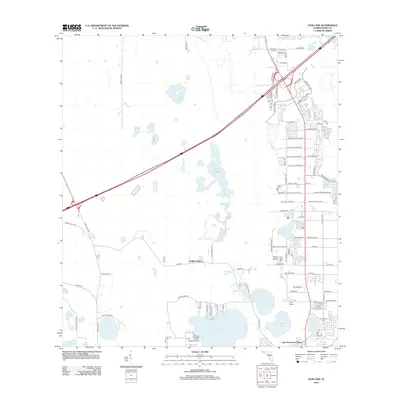
2012 Map of Gum Lake
USGS Topo · Published 2012About this map
Lake Lowery and its surrounding wetlands anchor this landscape in Polk County during a period of expanding residential development. The map reveals a transition from traditional citrus groves, evidenced by road names like Holly Hill Grove 1 Rd and Holly Hill Fruit Rd, to modern retirement and residential communities such as Holiday Manor and Lake Hammock Village. Transportation infrastructure is dominated by the highway corridor cutting through the center, while aviation history is represented by the Gore Airport and the Oak Harbor Seaplane Base on the northern shore of Lake Lowery. Further north, the Davenport Fire Tower stands as a sentinel over the terrain, overlooking numerous water bodies including Lake Saint Charles and Crystal Lake.
Find a feature on this map
90 named features on this map. Tap any name to fly to it.
Don’t see what you’re looking for? This feature index may not catch every label — zoom into the map to look around manually.
Map Details
Editions of this 2012 Gum Lake Map
This is the sole edition of this map. No revisions or reprints were ever made.
Other maps of this area

1944 · Polk City
USGS Topo · 1:31,680

1944 · Auburndale
USGS Topo · 1:31,680

1953 · Dundee
USGS Topo · 1:24,000

1953 · Intercession City
USGS Topo · 1:24,000

1953 · Davenport
USGS Topo · 1:24,000

1955 · Orlando
USGS Topo · 1:250,000

1957 · Orlando
USGS Topo · 1:250,000

1958 · Orlando
USGS Topo · 1:250,000

1959 · Gum Lake
USGS Topo · 1:24,000

1959 · Lake Louisa SW
USGS Topo · 1:24,000