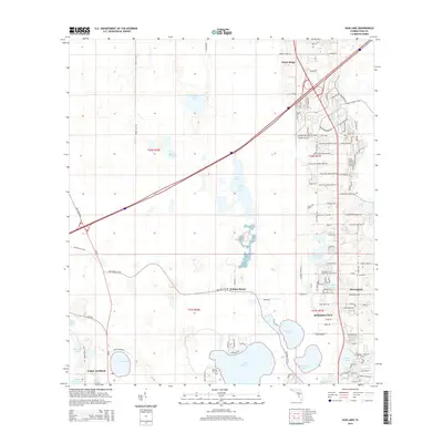
2015 Map of Gum Lake
USGS Topo · Published 2015About this map
Lake Alfred and Haines City anchor this 2015 study of Florida's interior lake country. The landscape is defined by its extensive hydrography, featuring major water bodies such as Lake Lowery, Gum Lake, and Bonnet Lake. A complex network of citrus-era roads, including several Minute Maid Ramp Road variations and numerous Holly Hill Grove routes, suggests the agricultural heritage of the region. The transition from grove land to residential development is visible in the structured street grids of Holiday Manor and Davenport. Aviation interest is represented by Gore Airport south of Hammock Lake. This survey illustrates a modern moment in Polk County where suburban expansion interfaces with an intricate wetland system, including smaller features like Duck Pond and Crystal Lake.
Find a feature on this map
110 named features on this map. Tap any name to fly to it.
Don’t see what you’re looking for? This feature index may not catch every label — zoom into the map to look around manually.
Map Details
Editions of this 2015 Gum Lake Map
This is the sole edition of this map. No revisions or reprints were ever made.
Other maps of this area

1944 · Polk City
USGS Topo · 1:31,680

1944 · Auburndale
USGS Topo · 1:31,680

1953 · Dundee
USGS Topo · 1:24,000

1953 · Intercession City
USGS Topo · 1:24,000

1953 · Davenport
USGS Topo · 1:24,000

1955 · Orlando
USGS Topo · 1:250,000

1957 · Orlando
USGS Topo · 1:250,000

1958 · Orlando
USGS Topo · 1:250,000

1959 · Gum Lake
USGS Topo · 1:24,000

1959 · Lake Louisa SW
USGS Topo · 1:24,000