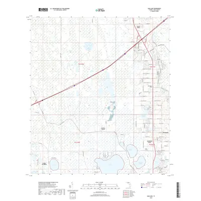
2018 Map of Gum Lake
USGS Topo · Published 2018About this map
The Green Swamp dominates the western portion of this Central Florida landscape, where a dense network of wetlands and small water bodies like Grass Lake and Lost Lake meet the rising elevations of the Lake Wales Ridge. This area is a critical hydrographic hub, featuring a complex of larger lakes including Lake Lowery, Gum Lake, and Bonnet Lake. The eastern corridor shows the rapid suburban and agricultural expansion typical of the early 21st century, with extensive road networks like Holly Hill Fruit Rd and Minute Maid Ramp Road 1 serving the region's citrus legacy.
Find a feature on this map
81 named features on this map. Tap any name to fly to it.
Don’t see what you’re looking for? This feature index may not catch every label — zoom into the map to look around manually.
Map Details
Editions of this 2018 Gum Lake Map
This is the sole edition of this map. No revisions or reprints were ever made.
Other maps of this area

1944 · Polk City
USGS Topo · 1:31,680

1944 · Auburndale
USGS Topo · 1:31,680

1953 · Dundee
USGS Topo · 1:24,000

1953 · Intercession City
USGS Topo · 1:24,000

1953 · Davenport
USGS Topo · 1:24,000

1955 · Orlando
USGS Topo · 1:250,000

1957 · Orlando
USGS Topo · 1:250,000

1958 · Orlando
USGS Topo · 1:250,000

1959 · Gum Lake
USGS Topo · 1:24,000

1959 · Lake Louisa SW
USGS Topo · 1:24,000