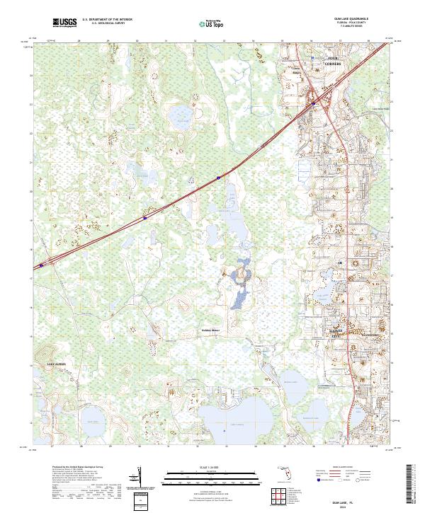
2024 Map of Gum Lake
USGS Topo · Published 2024About this map
Green Swamp dominates the northwest portion of this Polk County landscape, transitioning into the rapidly developing corridors of Haines City and Davenport. The map illustrates a complex hydrography characteristic of the Florida peninsula, featuring significant bodies of water such as Lake Lowery, Gum Lake, and the bird-foot shaped Bonnet Lake. The eastern edge reveals a dense network of suburban expansion and leisure infrastructure, particularly around Citrus Ridge and Four Corners, where golf-related street names like Caddy Dr and Par Pines Blvd signal the area's modern land-use patterns. Scattered amongst these newer developments are established landmarks like Gore Airport and small residential clusters like Holiday Manor. This detailed survey provides a clear look at the intersection of protected wetlands and the expanding urban footprint in Central Florida.
Find a feature on this map
108 named features on this map. Tap any name to fly to it.
Don’t see what you’re looking for? This feature index may not catch every label — zoom into the map to look around manually.
Map Details
Editions of this 2024 Gum Lake Map
This is the sole edition of this map. No revisions or reprints were ever made.
Other maps of this area

1944 · Polk City
USGS Topo · 1:31,680

1944 · Auburndale
USGS Topo · 1:31,680

1953 · Dundee
USGS Topo · 1:24,000

1953 · Intercession City
USGS Topo · 1:24,000

1953 · Davenport
USGS Topo · 1:24,000

1955 · Orlando
USGS Topo · 1:250,000

1957 · Orlando
USGS Topo · 1:250,000

1958 · Orlando
USGS Topo · 1:250,000

1959 · Gum Lake
USGS Topo · 1:24,000

1959 · Lake Louisa SW
USGS Topo · 1:24,000