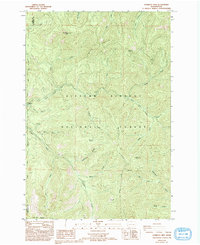
1986 Map of Gumboot Mtn
USGS Topo · Published 1994About this map
Gifford Pinchot National Forest dominates this topographic survey, revealing a landscape defined by the drainage systems of the East Fork Lewis River and the Washougal River. In the mid-1980s, this area of Skamania and Clark counties remained primarily a wilderness of steep ridges and creek valleys, though early industrial and recreational footprints are evident. The presence of several Mines, a Quarry, and a Borrow Pit suggests the extraction of local resources, while Sunset Campground marks a point of access for visitors to the high country. Notable landmarks such as Gumboot Mtn, Saturday Rock, and Silver Star Mountain provide high-elevation vantage points over the complex network of creeks like Tatoosh Creek and McKinley Creek. The map documents the specific locations of Summit Spring and McKinley Ridge, offering valuable data for those studying the physical history and land use of the Cascades.
Find a feature on this map
31 named features on this map. Tap any name to fly to it.
Don’t see what you’re looking for? This feature index may not catch every label — zoom into the map to look around manually.
Map Details
Editions of this 1986 Gumboot Mtn Map
2 editions found
Other maps of this area

1918 · Troutdale
USGS Topo · 1:62,500

1934 · Troutdale
USGS Topo · 1:48,000

1940 · Lookout Mtn
USGS Topo · 1:62,500

1941 · Yacolt
USGS Topo · 1:62,500

1941 · Camas
USGS Topo · 1:62,500

1942 · Camas
USGS Topo · 1:62,500

1948 · Vancouver
USGS Topo · 1:250,000

1950 · Vancouver
USGS Topo · 1:250,000

1950 · Vancouver
USGS Topo · 1:250,000

1953 · Lookout Mtn
USGS Topo · 1:62,500