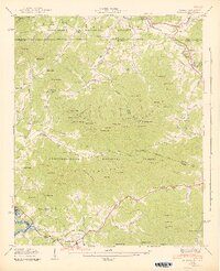
1942 Map of Gumlog
USGS Topo · Published 1942About this map
The mountain town of Blairsville sits at the southern edge of this Blue Ridge survey, just before the Nottely Reservoir (Elev 1780) began to reshape the local hydrology. This 1940s landscape is defined by the proximity of the Nantahala National Forest and Chattahoochee National Forest, where steep ridgelines like Turkey Knob and Poplar Knob separate narrow valleys and coves. The map captures a transition in rural life, with numerous community institutions still active across the hills, including Smyrna Sch, Gumlog Sch, and Many Forks Ch.
Find a feature on this map
137 named features on this map. Tap any name to fly to it.
Don’t see what you’re looking for? This feature index may not catch every label — zoom into the map to look around manually.
Map Details
Editions of this 1942 Gumlog Map
2 editions found
Other maps of this area

1886 · Dahlonega
USGS Topo · 1:125,000

1888 · Ellijay
USGS Topo · 1:125,000

1892 · Dahlonega
USGS Topo · 1:125,000

1892 · Ellijay
USGS Topo · 1:125,000

1893 · Murphy
USGS Topo · 1:125,000

1896 · Dahlonega
USGS Topo · 1:125,000

1898 · Ellijay
USGS Topo · 1:125,000

1903 · Dahlonega
USGS Topo · 1:125,000

1911 · Ellijay
USGS Topo · 1:125,000

1914 · Murphy
USGS Topo · 1:125,000