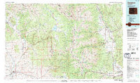
1984 Map of Gunnison
USGS Topo · Published 1984About this map
The Sawatch Range and the Elk Mountains dominate this 1984 study, documenting the high-altitude geography of central Colorado before the modern expansion of its mountain towns. The seat at Gunnison serves as the regional hub, anchored by Western State College, while the Denver and Rio Grande Western railroad corridor follows the southern valleys. High in the peaks, former mining centers such as St Elmo, Tincup, and Iron City appear alongside active communities like Crested Butte and Mount Crested Butte. The landscape is a complex network of hydrological systems, with the Taylor River flowing from the Taylor Park Reservoir to meet the Gunnison River. On the eastern slope, the Arkansas River drainage connects settlements like Buena Vista and Poncha Springs, providing a clear view of the mountain passes and remote basins that defined the area's development.
Find a feature on this map
72 named features on this map. Tap any name to fly to it.
Don’t see what you’re looking for? This feature index may not catch every label — zoom into the map to look around manually.
Map Details
Editions of this 1984 Gunnison Map
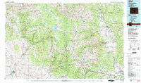
2 editions found
Other maps of this area

1888 · Crested Butte
USGS Topo · 1:62,500

1888 · Anthracite
USGS Topo · 1:62,500

1889 · Crested Butte
USGS Topo · 1:62,500

1889 · Anthracite
USGS Topo · 1:62,500

1889 · Leadville
USGS Topo · 1:125,000

1891 · Leadville
USGS Topo · 1:125,000

1893 · Anthracite
USGS Topo · 1:62,500

1893 · Crested Butte
USGS Topo · 1:62,500

1893 · Aspen
USGS Topo · 1:62,500

1894 · Anthracite
USGS Topo · 1:62,500