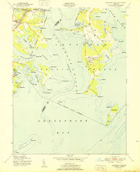
1951 Map of Gunpowder Neck
USGS Topo · Published 1951About this map
The Aberdeen Proving Ground dominates the eastern landscape of the Gunpowder Neck, illustrating the heavy military footprint along the upper Chesapeake Bay during the mid-century. This shoreline is defined by a complex network of inlets and peninsulas, including Dundee Creek and Saltpeter Creek, which separate significant landmasses like Carroll Island and Graces Quarters.
Find a feature on this map
53 named features on this map. Tap any name to fly to it.
Don’t see what you’re looking for? This feature index may not catch every label — zoom into the map to look around manually.
Map Details
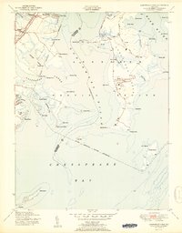
Editions of this 1951 Gunpowder Neck Map
2 editions found
Other maps of this area

1893 · North Point
USGS Topo · 1:62,500

1893 · Gunpowder
USGS Topo · 1:62,500

1898 · Tolchester
USGS Topo · 1:125,000

1900 · Betterton
USGS Topo · 1:62,500

1901 · Chestertown
USGS Topo · 1:62,500

1901 · Gunpowder
USGS Topo · 1:62,500

1903 · Tolchester
USGS Topo · 1:125,000

1904 · North Point
USGS Topo · 1:62,500

1908 · Tolchester
USGS Topo · 1:125,000

1920 · Chestertown
USGS Topo · 1:62,500