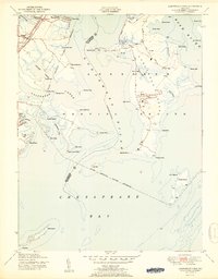
1951 Map of Gunpowder Neck
USGS Topo · Published 1951About this map
The Aberdeen Proving Ground dominates this coastal landscape along the Gunpowder River, showcasing the extensive military footprint on the western shore of the Chesapeake Bay during the early Cold War era. The map details a complex network of peninsulas and necks, including Graces Quarters and Carroll Island, which were increasingly repurposed for defense testing and strategic use. Inland, the influence of the Pennsylvania Railroad is evident with stops at Chase Station and Harewood Station, facilitating the growth of nearby residential and recreational pockets like Harewood Park and the waterfront community of Miami Beach. The maritime character of the region is further emphasized by the presence of Pooles Island and its lighthouse, standing as critical navigational markers where the Bush River meets the bay. This survey captures a moment when traditional waterfront leisure at Seneca Park existed alongside the high-security operations of the military reservation.
Find a feature on this map
57 named features on this map. Tap any name to fly to it.
Don’t see what you’re looking for? This feature index may not catch every label — zoom into the map to look around manually.
Map Details
Editions of this 1951 Gunpowder Neck Map
2 editions found
Other maps of this area

1893 · North Point
USGS Topo · 1:62,500

1893 · Gunpowder
USGS Topo · 1:62,500

1898 · Tolchester
USGS Topo · 1:125,000

1900 · Betterton
USGS Topo · 1:62,500

1901 · Chestertown
USGS Topo · 1:62,500

1901 · Gunpowder
USGS Topo · 1:62,500

1903 · Tolchester
USGS Topo · 1:125,000

1904 · North Point
USGS Topo · 1:62,500

1908 · Tolchester
USGS Topo · 1:125,000

1920 · Chestertown
USGS Topo · 1:62,500