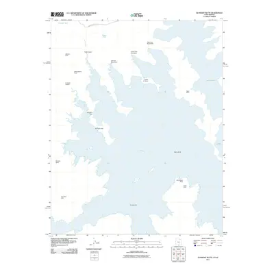
2011 Map of Gunsight Butte
USGS Topo · Published 2011About this map
Lake Powell dominates this high-desert landscape on the border of Utah and Arizona, where rising water levels have historically reshaped the accessibility of local landforms. The intricate shoreline winds around prominent geological features like Gunsight Butte and Padres Butte, while former terrestrial markers such as Gunsight Bar are shown in relation to the expanded reservoir. This 2011 survey captures the area decades after the completion of the Glen Canyon Dam, illustrating how the inundation transformed old drainage systems like Padre Creek and the Left Fork Kane Wash into deep-water inlets. Inland, the high ground remains accessible via Smokey Mountain Rd, leading to vantage points like Alstrom Point and Little Alstrom Point. The map provides a clear view of how modern recreation and historical geography intersect across Romana Mesa and The Sand Hills.
Find a feature on this map
22 named features on this map. Tap any name to fly to it.
Don’t see what you’re looking for? This feature index may not catch every label — zoom into the map to look around manually.
Map Details
Editions of this 2011 Gunsight Butte Map
This is the sole edition of this map. No revisions or reprints were ever made.
Other maps of this area

1886 · Escalante
USGS Topo · 1:250,000

1886 · Echo Cliffs
USGS Topo · 1:250,000

1891 · Echo Cliffs
USGS Topo · 1:250,000

1922 · Warm Creek
USGS Topo · 1:63,360

1953 · Cummings Mesa
USGS Topo · 1:62,500

1953 · Gunsight Butte
USGS Topo · 1:62,500

1954 · Leche-E Rock
USGS Topo · 1:62,500

1954 · Navajo Creek
USGS Topo · 1:62,500

1956 · Escalante
USGS Topo · 1:250,000

1956 · Marble Canyon
USGS Topo · 1:250,000