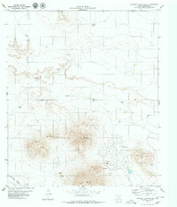
1979 Map of Gunsight Hills South
USGS Topo · Published 1979About this map
Sierra Blanca and Little Blanca Mountain dominate this corner of Hudspeth County, where the desert floor meets significant relief. The landscape is defined by the critical infrastructure of the late 1970s, notably the parallel lines of the Texas and Pacific and Southern Pacific railroads which skirt the southern reaches of the quadrangle. Water management is central to life in this arid environment, evidenced by a network of distributed tanks and wells such as Gunsight Tank, Pajaro Tank, and Ward Tank that support local ranching or transit needs. Significant geological landmarks including Little Round Top and Triple Hill provide orientation points across the terrain, while the winding Arroyo Balluco and Lasca Branch mark the natural drainage patterns. The map also captures human imprints like a Golf Course and several prospects, suggesting a mix of recreational and mineral interests near Mile High.
Find a feature on this map
26 named features on this map. Tap any name to fly to it.
Don’t see what you’re looking for? This feature index may not catch every label — zoom into the map to look around manually.
Map Details
Editions of this 1979 Gunsight Hills South Map
This is the sole edition of this map. No revisions or reprints were ever made.
Other maps of this area

1894 · Fort Hancock
USGS Topo · 1:125,000

1895 · Sierra Blanca
USGS Topo · 1:125,000

1943 · Fort Quitman
USGS Topo · 1:62,500

1943 · Finlay Mountains
USGS Topo · 1:62,500

1948 · Triple Hill
USGS Topo · 1:62,500

1954 · Van Horn
USGS Topo · 1:250,000

1958 · Van Horn
USGS Topo · 1:250,000

1964 · Lasca
USGS Topo · 1:24,000
1964 · Sierra Blanca
USGS Topo · 1:24,000
1972 · Silver King Canyon
USGS Topo · 1:24,000