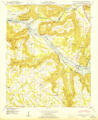
1950 Map of Guntersville Dam
USGS Topo · Published 1950About this map
Guntersville Dam anchors this mid-century landscape where the Tennessee River transitions into the expansive Wheeler Reservoir. The map reveals a complex river-valley economy and geography just after the war, marked by large government tracts like the Merrill Reservation and the Robertson Reservation. While the reservoir dominates the center, the surrounding uplands of Merrill Mountain and Georgia Mountain are dotted with small rural institutions, including the Beach Spring Cem Bean Rock School and Mobbs School. Settlement patterns are concentrated near Union Grove and Black Center, with the N C & St L Ry and its associated N C & St L Ry Ferry providing vital transportation links across the water. Local industry is represented by Neighbors Mill on Shoal Creek, while numerous family cemeteries and churches like Sweet Home Church testify to the area's deep-rooted community history.
Find a feature on this map
78 named features on this map. Tap any name to fly to it.
Don’t see what you’re looking for? This feature index may not catch every label — zoom into the map to look around manually.
Map Details
Editions of this 1950 Guntersville Dam Map
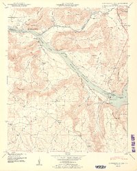
2 editions found
Other maps of this area

1885 · Gadsden
USGS Topo · 1:125,000

1888 · Cullman
USGS Topo · 1:125,000

1888 · Gadsden
USGS Topo · 1:125,000

1888 · Scottsboro
USGS Topo · 1:125,000

1888 · Huntsville
USGS Topo · 1:125,000

1892 · Cullman
USGS Topo · 1:125,000

1892 · Huntsville
USGS Topo · 1:125,000

1892 · Scottsboro
USGS Topo · 1:125,000

1892 · Gadsden
USGS Topo · 1:125,000

1895 · Gadsden
USGS Topo · 1:125,000