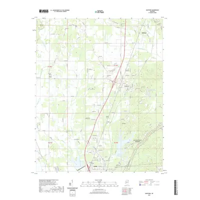
2020 Map of Guntown
USGS Topo · Published 2020About this map
Guntown and Saltillo anchor the central corridor of this northeast Mississippi landscape, situated along the Kansas City Southern railroad line. The map reveals a dense network of family and community history, evidenced by numerous burial sites such as Old Bethel Cem, Guntown Cem, and the Taylor Family Cem. The terrain is defined by the headwaters and branches of Euclatubba Cr and Flat Cr, which drain the low-lying areas between the settlements of Blair and Pea Ridge. Large water bodies like Lake Lamar Bruce and Five County Sportsman Lake indicate the importance of managed water resources and recreation in the local geography. The map provides a contemporary view of Lee and Union counties, showing how modern county roads have developed around long-established landmarks like Mount Zion Church Cem and the Singleton Hall Cem.
Find a feature on this map
137 named features on this map. Tap any name to fly to it.
Don’t see what you’re looking for? This feature index may not catch every label — zoom into the map to look around manually.
Map Details
Editions of this 2020 Guntown Map
This is the sole edition of this map. No revisions or reprints were ever made.
Other maps of this area

1921 · Booneville
USGS Topo · 1:48,000

1921 · Tupelo
USGS Topo · 1:48,000

1922 · Booneville
USGS Topo · 1:62,500

1923 · Tupelo
USGS Topo · 1:62,500

1955 · Ripley
USGS Topo · 1:62,500

1955 · Sherman
USGS Topo · 1:62,500

1956 · Tupelo
USGS Topo · 1:250,000

1958 · Tupelo
USGS Topo · 1:250,000

1965 · Mooreville
USGS Topo · 1:24,000

1973 · Guntown
USGS Topo · 1:24,000