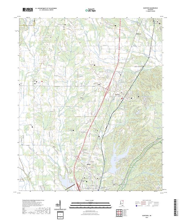
2024 Map of Guntown
USGS Topo · Published 2024About this map
Guntown and Saltillo anchor this north Mississippi landscape, where the headwaters of numerous creeks carve through the terrain of Pea Ridge. The map reveals a dense network of family and community burial grounds, such as Alice Memorial Cem, Gaston Cem, and the Francis Family Cem, which speak to the deep genealogical roots of Lee County. Water is a defining element of the local geography, from the winding course of Euclautubba Creek to the recreational expanse of Lake Lamar Bruce in the south and Five County Sportsman Lake to the east. The northern edge of the survey captures the southern reaches of Baldwyn, showing how these established settlements are connected by a web of county roads and the modern corridor that parallels the historic path of the Natchez Trace. Smaller locales like Blair and landmarks like Singleton Hall Cem further illustrate the distribution of rural community life across this segment of the state.
Find a feature on this map
150 named features on this map. Tap any name to fly to it.
Don’t see what you’re looking for? This feature index may not catch every label — zoom into the map to look around manually.
Map Details
Editions of this 2024 Guntown Map
This is the sole edition of this map. No revisions or reprints were ever made.
Other maps of this area

1921 · Booneville
USGS Topo · 1:48,000

1921 · Tupelo
USGS Topo · 1:48,000

1922 · Booneville
USGS Topo · 1:62,500

1923 · Tupelo
USGS Topo · 1:62,500

1955 · Ripley
USGS Topo · 1:62,500

1955 · Sherman
USGS Topo · 1:62,500

1956 · Tupelo
USGS Topo · 1:250,000

1958 · Tupelo
USGS Topo · 1:250,000

1965 · Mooreville
USGS Topo · 1:24,000

1973 · Guntown
USGS Topo · 1:24,000