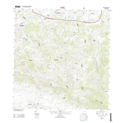
2013 Map of Gurabo
USGS Topo · Published 2013About this map
Gurabo and Trujillo Alto sit within a landscape defined by the winding paths of the Rio Gurabo and the Rio Grande De Loiza. This 2013 survey illustrates the dense network of local roads and communities that have grown along these vital waterways. Prominent peaks like Cerro Pitahaya and Cerro Gordo rise above the valleys, while localized settlements such as Campo Rico and Benítez are shown in detail. The presence of the Cementerio Rural de Gurabo provides a key reference point for local history and genealogy. The map also delineates several municipal boundaries, including those between Carolina, Canóvanas, and Gurabo, reflecting the administrative organization of the region at the start of the decade. Hydrological features like Quebrada Bocaforma and Rio Canovanillas emphasize the complex drainage patterns of this varied terrain.
Find a feature on this map
45 named features on this map. Tap any name to fly to it.
Don’t see what you’re looking for? This feature index may not catch every label — zoom into the map to look around manually.
Map Details
Editions of this 2013 Gurabo Map
This is the sole edition of this map. No revisions or reprints were ever made.
Other maps of this area

1940 · Carolina
USGS Topo · 1:30,000

1941 · San Juan
USGS Topo · 1:30,000

1941 · Rio Grande
USGS Topo · 1:30,000

1941 · Carolina
USGS Topo · 1:30,000

1945 · El Yunque
USGS Topo · 1:30,000

1946 · El Yunque
USGS Topo · 1:30,000

1946 · Aguas Buenas
USGS Topo · 1:30,000

1946 · Humacao
USGS Topo · 1:30,000

1946 · Gurabo
USGS Topo · 1:30,000

1946 · Juncos
USGS Topo · 1:30,000
Featured Places
- Gurabo
- Mariana, Carolina
- Sector Goyo Márquez, Gurabo
- La Marina, Canóvanas
- Sector Fruto Alemán, Trujillo Alto