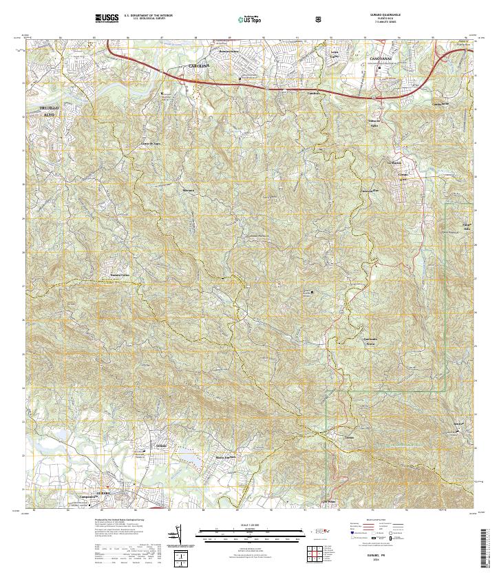
2024 Map of Gurabo
USGS Topo · Published 2024About this map
El Yunque National Forest anchors the southeastern corner of this modern survey, where the peaks of Cuchilla el Asomante rise above the complex river networks of the Río Canóvanas and Río Gurabo. The landscape transitions from the dense urban developments of Carolina and Canóvanas in the north to the higher elevations and rural sectors of Gurabo in the south. This transition reveals a pattern of modern residential expansion through Loíza Valley and Buenaventura contrasted with the traditional, scattered settlements found in the southern ridges.
Find a feature on this map
75 named features on this map. Tap any name to fly to it.
Don’t see what you’re looking for? This feature index may not catch every label — zoom into the map to look around manually.
Map Details
Editions of this 2024 Gurabo Map
This is the sole edition of this map. No revisions or reprints were ever made.
Other maps of this area

1940 · Carolina
USGS Topo · 1:30,000

1941 · San Juan
USGS Topo · 1:30,000

1941 · Rio Grande
USGS Topo · 1:30,000

1941 · Carolina
USGS Topo · 1:30,000

1945 · El Yunque
USGS Topo · 1:30,000

1946 · El Yunque
USGS Topo · 1:30,000

1946 · Aguas Buenas
USGS Topo · 1:30,000

1946 · Humacao
USGS Topo · 1:30,000

1946 · Gurabo
USGS Topo · 1:30,000

1946 · Juncos
USGS Topo · 1:30,000
Featured Places
- Gurabo
- Mariana, Carolina
- Sector Goyo Márquez, Gurabo
- La Marina, Canóvanas
- Sector Fruto Alemán, Trujillo Alto