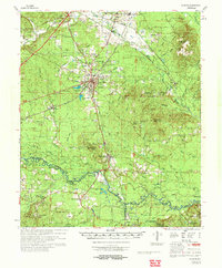
1972 Map of Gurdon
USGS Topo · Published 1973About this map
Gurdon serves as the central hub in this early 1970s study, where the Missouri Pacific railroad lines converge and local industry is marked by numerous Gravel Pits and the Gurdon Municipal Airfield. The landscape is defined by the winding course of the Little Missouri River, which forms the boundary between Clark, Nevada, and Ouachita counties. This river system, accompanied by features like Minnie Slough and Bolin Slough, dictates the placement of rural settlements and several smaller water bodies such as Horn Lake and Salt Lake.
Find a feature on this map
92 named features on this map. Tap any name to fly to it.
Don’t see what you’re looking for? This feature index may not catch every label — zoom into the map to look around manually.
Map Details
Editions of this 1972 Gurdon Map
This is the sole edition of this map. No revisions or reprints were ever made.
Other maps of this area

1901 · Gurdon
USGS Topo · 1:125,000

1903 · Camden
USGS Topo · 1:125,000

1943 · Antoine
USGS Topo · 1:62,500

1953 · El Dorado
USGS Topo · 1:250,000

1955 · Little Rock
USGS Topo · 1:250,000

1956 · Little Rock
USGS Topo · 1:250,000

1957 · El Dorado
USGS Topo · 1:250,000

1958 · El Dorado
USGS Topo · 1:250,000

1959 · Arkadelphia
USGS Topo · 1:24,000

1960 · El Dorado
USGS Topo · 1:250,000