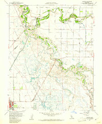
1960 Map of Gustine
USGS Topo · Published 1961About this map
The confluence of the San Joaquin River and the Merced River defines this Central Valley landscape, where complex water management systems of the 1960s intersect with older pioneer landmarks. The map documents a transition from river-based transport to an irrigation-dependent economy, evidenced by the numerous Duck Ponds and the extensive San Luis Canal network. Local history is anchored by Hills Ferry, once a vital river crossing, and Fremont Ford, which by this era had become a state park. The town of Gustine appears as the primary hub in the southwest, supported by the Gustine Airport and industrial sites like the sewage disposal facility. Further east, the Stevinson Home Ranch and Stevinson Sunnyside Cem reflect the area’s agricultural roots, while the Old Santa Fe Grade marks the path of earlier rail infrastructure through the marshes of San Luis Island.
Find a feature on this map
51 named features on this map. Tap any name to fly to it.
Don’t see what you’re looking for? This feature index may not catch every label — zoom into the map to look around manually.
Map Details
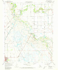
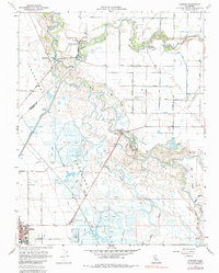
Editions of this 1960 Gustine Map
3 editions found
Other maps of this area

1916 · Mitchell School
USGS Topo · 1:31,680

1916 · Crows Landing
USGS Topo · 1:31,680

1917 · Turlock
USGS Topo · 1:31,680

1917 · Newman
USGS Topo · 1:31,680

1918 · Stevinson
USGS Topo · 1:31,680

1918 · Gustine
USGS Topo · 1:31,680

1919 · Orestimba
USGS Topo · 1:62,500

1919 · San Luis Ranch
USGS Topo · 1:31,680

1919 · Ingomar
USGS Topo · 1:31,680

1920 · Pacheco Pass
USGS Topo · 1:62,500