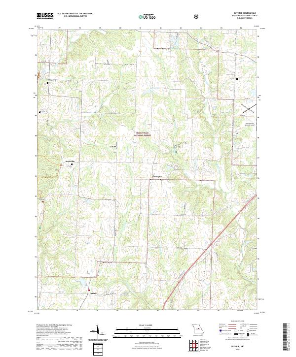
2021 Map of Guthrie
USGS Topo · Published 2021About this map
Guthrie and Carrington anchor this section of Callaway County, where the transition from open agricultural land to the wooded tracts of the Mark Twain National Forest is clearly visible. The landscape is defined by several drainage systems, including Millers Cr, Smith Cr, and the Middle River, which carve through the terrain between prominent features like Round Prairie and Robin Ridge. Family and community history is preserved in a high density of small burial grounds, such as Millers Creek Cem, Hundley Cem, and Paris Fork Cem, reflecting the area's deep-rooted rural settlement patterns. Near the northeastern corner, the Elton Hensley Memorial Airport provides a modern navigational point, while sites like the Carrington Pits Rec Area and Reeds Lake indicate local land use focused on recreation and resource management.
Find a feature on this map
49 named features on this map. Tap any name to fly to it.
Don’t see what you’re looking for? This feature index may not catch every label — zoom into the map to look around manually.
Map Details
Editions of this 2021 Guthrie Map
This is the sole edition of this map. No revisions or reprints were ever made.
Other maps of this area

1886 · Jefferson City
USGS Topo · 1:125,000

1890 · Fulton
USGS Topo · 1:125,000

1894 · Jefferson City
USGS Topo · 1:125,000

1928 · Fulton
USGS Topo · 1:62,500

1931 · Fulton
USGS Topo · 1:62,500

1939 · Jefferson City
USGS Topo · 1:62,500

1942 · Jefferson City
USGS Topo · 1:62,500

1944 · Millersburg
USGS Topo · 1:62,500

1945 · Mokane
USGS Topo · 1:62,500

1946 · Millersburg
USGS Topo · 1:62,500