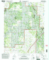
2000 Map of Guthrie
USGS Topo · Published 2003About this map
Guthrie and the surrounding wooded terrain of Callaway County appear at the turn of the millennium, defined by a landscape where agriculture meets industrial extraction. Much of the central and eastern portion of the map is occupied by the Mark Twain National Forest, though significant private holdings remain throughout the timberlands. The economic history of the area is etched into the earth through numerous strip mines, a Quarry, and a Clay Pit, showing the heavy footprint of mineral and resource removal in the hills surrounding Middle River.
Find a feature on this map
32 named features on this map. Tap any name to fly to it.
Don’t see what you’re looking for? This feature index may not catch every label — zoom into the map to look around manually.
Map Details
Editions of this 2000 Guthrie Map
This is the sole edition of this map. No revisions or reprints were ever made.
Other maps of this area

1886 · Jefferson City
USGS Topo · 1:125,000

1890 · Fulton
USGS Topo · 1:125,000

1894 · Jefferson City
USGS Topo · 1:125,000

1928 · Fulton
USGS Topo · 1:62,500

1931 · Fulton
USGS Topo · 1:62,500

1939 · Jefferson City
USGS Topo · 1:62,500

1942 · Jefferson City
USGS Topo · 1:62,500

1944 · Millersburg
USGS Topo · 1:62,500

1945 · Mokane
USGS Topo · 1:62,500

1946 · Millersburg
USGS Topo · 1:62,500