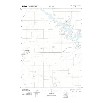
2010 Map of Guthrie Center East
USGS Topo · Published 2010About this map
Lake Panorama and its associated resorts dominate the northeastern corner of this Iowa landscape, where the Middle Raccoon River was impounded by the Lake Panorama Dam. This man-made reservoir stands in contrast to the traditional agricultural grid and scattered small settlements like Fanslers and Monteith. For genealogists, the map is remarkably dense with burial sites, showing a legacy of rural churchyards and family plots including Victory Union Cemetery, Resurrection Cemetery, and the Valley Township Cemetery located just outside the eastern edge of Guthrie Center. The town itself serves as the western anchor of the sheet, with the South Raccoon River cutting through its southern reaches. Further infrastructure includes the Guthrie County Regional Airport and recreational points such as the Lake Panorama National Resort, illustrating the area's dual role as a farming hub and a regional leisure destination.
Find a feature on this map
20 named features on this map. Tap any name to fly to it.
Don’t see what you’re looking for? This feature index may not catch every label — zoom into the map to look around manually.
Map Details
Editions of this 2010 Guthrie Center East Map
This is the sole edition of this map. No revisions or reprints were ever made.
Other maps of this area

1952 · Panora
USGS Topo · 1:62,500

1954 · Bagley
USGS Topo · 1:62,500

1954 · Omaha
USGS Topo · 1:250,000

1957 · Omaha
USGS Topo · 1:250,000

1958 · Omaha
USGS Topo · 1:250,000

1971 · Bayard
USGS Topo · 1:24,000

1971 · Casey
USGS Topo · 1:24,000

1971 · Guthrie Center West
USGS Topo · 1:24,000

1982 · Guthrie Center East
USGS Topo · 1:24,000

1982 · Panora
USGS Topo · 1:24,000