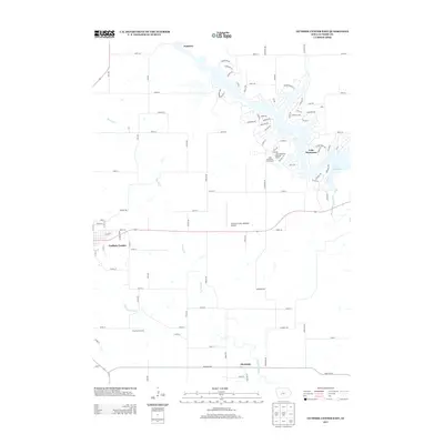
2013 Map of Guthrie Center East
USGS Topo · Published 2013About this map
Guthrie Center serves as the western anchor of this topographic study, where the local street grid including Bluff St and Grand St meets the open agricultural landscape of Guthrie County. To the east, the Middle Raccoon River has been transformed by the creation of Lake Panorama, a sprawling water body surrounded by a dense network of residential drives and the Lake Panorama National Resort Golf Course. This 2013 survey illustrates the balance between established municipal centers and modern recreational development. Further south, the course of the S Raccoon River winds past the settlement of Monteith, while the northern reaches include the community of Fanslers. Transportation and utility infrastructure are represented by the Guthrie County Regional Airport and the transition from paved state routes to gravel tracks like Nomad Trl and Soldier Trl.
Find a feature on this map
87 named features on this map. Tap any name to fly to it.
Don’t see what you’re looking for? This feature index may not catch every label — zoom into the map to look around manually.
Map Details
Editions of this 2013 Guthrie Center East Map
This is the sole edition of this map. No revisions or reprints were ever made.
Other maps of this area

1952 · Panora
USGS Topo · 1:62,500

1954 · Bagley
USGS Topo · 1:62,500

1954 · Omaha
USGS Topo · 1:250,000

1957 · Omaha
USGS Topo · 1:250,000

1958 · Omaha
USGS Topo · 1:250,000

1971 · Bayard
USGS Topo · 1:24,000

1971 · Casey
USGS Topo · 1:24,000

1971 · Guthrie Center West
USGS Topo · 1:24,000

1982 · Guthrie Center East
USGS Topo · 1:24,000

1982 · Panora
USGS Topo · 1:24,000