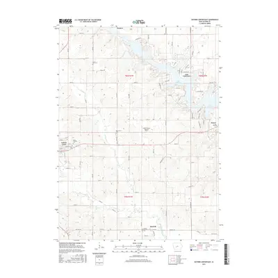
2015 Map of Guthrie Center East
USGS Topo · Published 2015About this map
Lake Panorama dominates the northeastern landscape of this Guthrie County region, its winding shoreline and residential developments like Canfield Dr and Cornelius Rd contrasting with the geometric grid of agricultural sections to the west. The local economy and transportation network are centered around Guthrie Center and the Guthrie County Regional Airport, while the waterways of the Middle Raccoon River and South Raccoon River carve natural paths through the farmland. Genealogists will find a high density of burial sites documented across the township, from the centrally located Resurrection Cem to the Valley Township Cem and Victory Union Cem. The map captures the interface between the established rural settlements of Fanslers and Monteith and the modern recreational infrastructure surrounding the reservoir.
Find a feature on this map
78 named features on this map. Tap any name to fly to it.
Don’t see what you’re looking for? This feature index may not catch every label — zoom into the map to look around manually.
Map Details
Editions of this 2015 Guthrie Center East Map
This is the sole edition of this map. No revisions or reprints were ever made.
Other maps of this area

1952 · Panora
USGS Topo · 1:62,500

1954 · Bagley
USGS Topo · 1:62,500

1954 · Omaha
USGS Topo · 1:250,000

1957 · Omaha
USGS Topo · 1:250,000

1958 · Omaha
USGS Topo · 1:250,000

1971 · Bayard
USGS Topo · 1:24,000

1971 · Casey
USGS Topo · 1:24,000

1971 · Guthrie Center West
USGS Topo · 1:24,000

1982 · Guthrie Center East
USGS Topo · 1:24,000

1982 · Panora
USGS Topo · 1:24,000