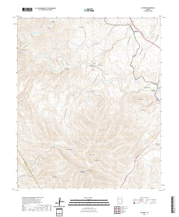
2021 Map of Guthrie
USGS Topo · Published 2021About this map
Clifton serves as the primary hub in this arid landscape where the San Francisco River cuts through the high desert terrain. The area's settlement pattern follows the precarious geography of the river valley, with the small community of Guthrie positioned further south along the transport corridors that navigate the deep canyons and peaks. This 2021 update reveals the persistence of these isolated outposts in a region defined by steep topographical shifts and the critical importance of riparian access in the desert. The mapping shows how modern infrastructure continues to rely on the natural pathways carved by the river, linking the remote copper-mining heritage of the northern reaches with the broader geography of Greenlee County.
Find a feature on this map
3 named features on this map. Tap any name to fly to it.
Don’t see what you’re looking for? This feature index may not catch every label — zoom into the map to look around manually.
Map Details
Editions of this 2021 Guthrie Map
This is the sole edition of this map. No revisions or reprints were ever made.
Other maps of this area

1902 · Clifton
USGS Topo · 1:62,500

1913 · Morenci
USGS Topo · 1:125,000

1915 · Morenci
USGS Topo · 1:125,000

1954 · Silver City
USGS Topo · 1:250,000

1954 · Clifton
USGS Topo · 1:250,000

1957 · Clifton
USGS Topo · 1:250,000

1958 · Silver City
USGS Topo · 1:250,000

1958 · Clifton
USGS Topo · 1:250,000

1959 · York Valley
USGS Topo · 1:62,500

1960 · Guthrie
USGS Topo · 1:62,500