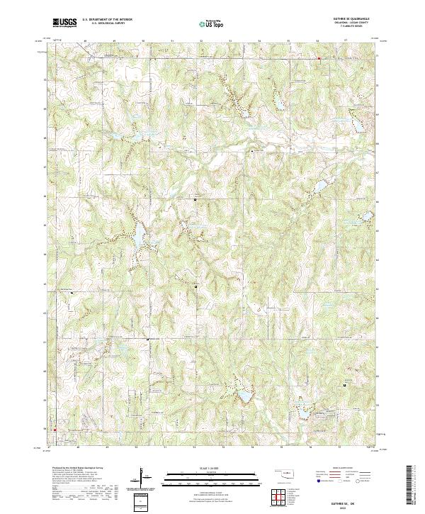
2022 Map of Guthrie SE
USGS Topo · Published 2022About this map
Small family and community burial grounds punctuate the landscape of southeastern Logan County, where the terrain is defined by the intricate watershed of Bear Cr and its many tributaries. The area is marked by a sophisticated system of water management, featuring named reservoirs like Bear Fall Coon Cr Site 11 Reservoir and Bear Fall Coon Cr Site 12 Reservoir which support the local agricultural and drainage needs. Genealogical interest is high given the distribution of historic sites such as Rising Sun Cem, Oak Ridge Cem, and the Evansville Cem located in the southeastern quadrant. The survey reveals a grid of rural roads including E Seward Rd and E Charter Oak Rd, connecting various property sections while navigating the winding paths of Blue Creek and Fall Cr.
Find a feature on this map
97 named features on this map. Tap any name to fly to it.
Don’t see what you’re looking for? This feature index may not catch every label — zoom into the map to look around manually.
Map Details
Editions of this 2022 Guthrie SE Map
This is the sole edition of this map. No revisions or reprints were ever made.
Other maps of this area

1892 · Guthrie
USGS Topo · 1:62,500

1892 · Edmond
USGS Topo · 1:62,500

1909 · Luther
USGS Topo · 1:62,500

1909 · Perkins
USGS Topo · 1:62,500

1935 · Edmond
USGS Topo · 1:48,000

1940 · Edmond
USGS Topo · 1:62,500

1954 · Oklahoma City
USGS Topo · 1:250,000

1957 · Oklahoma City
USGS Topo · 1:250,000

1963 · Oklahoma City
USGS Topo · 1:250,000
1966 · Arcadia
USGS Topo · 1:24,000