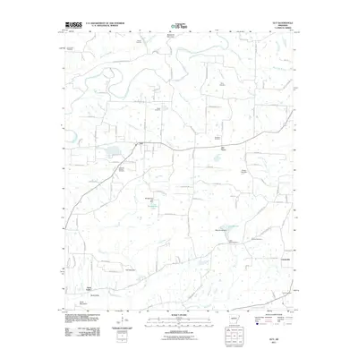
2011 Map of Guy
USGS Topo · Published 2011About this map
Guy and Old Texas anchor this survey of north-central Arkansas, where the landscape is defined by the headwaters of Cadron Creek and its many tributaries. The area is notable for its concentration of family and community burial grounds, including the Old Texas Cemetery, King Cemetery, and Copperas Springs Cemetery, which offer valuable coordinates for genealogical research. To the south, the terrain transitions into the recreation-focused area of Wooley Hollow, featuring Lake Bennett and its associated dam. The geography is marked by distinctive natural formations such as The Narrows and Soda Mountain, which overlook the rural settlement of Soda Valley. This 2011 rendering shows a network of named county roads and residential lanes that connect these small communities to the surrounding creeks and ridges, reflecting a modern layout that respects the historic placement of original homesites and cemeteries.
Find a feature on this map
101 named features on this map. Tap any name to fly to it.
Don’t see what you’re looking for? This feature index may not catch every label — zoom into the map to look around manually.
Map Details
Editions of this 2011 Guy Map
This is the sole edition of this map. No revisions or reprints were ever made.
Other maps of this area

1956 · Russellville
USGS Topo · 1:250,000

1961 · Conway
USGS Topo · 1:62,500

1961 · Bee Branch
USGS Topo · 1:62,500

1961 · Greenbrier
USGS Topo · 1:24,000

1961 · Bee Branch
USGS Topo · 1:24,000

1961 · Morganton
USGS Topo · 1:24,000

1961 · Damascus
USGS Topo · 1:24,000

1961 · Guy
USGS Topo · 1:24,000
1961 · Holland
USGS Topo · 1:24,000

1963 · Quitman
USGS Topo · 1:24,000