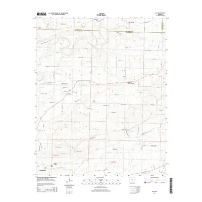
2014 Map of Guy
USGS Topo · Published 2014About this map
Guy sits at the intersection of local routes in this part of Faulkner County, serving as a central point for the surrounding rural communities of Old Texas and Centerville. The landscape is defined by the transition from the ridges of Batesville Mtn in the north to the valley floors where Cadron Creek and Black Fork drain the territory. This map documents a high density of family and community burial sites, including the Copper Springs Cem, Mode Cem, and McNew Cem, which provide essential touchpoints for genealogical research in the region.
Find a feature on this map
107 named features on this map. Tap any name to fly to it.
Don’t see what you’re looking for? This feature index may not catch every label — zoom into the map to look around manually.
Map Details
Editions of this 2014 Guy Map
This is the sole edition of this map. No revisions or reprints were ever made.
Other maps of this area

1956 · Russellville
USGS Topo · 1:250,000

1961 · Conway
USGS Topo · 1:62,500

1961 · Bee Branch
USGS Topo · 1:62,500

1961 · Greenbrier
USGS Topo · 1:24,000

1961 · Bee Branch
USGS Topo · 1:24,000

1961 · Morganton
USGS Topo · 1:24,000

1961 · Damascus
USGS Topo · 1:24,000

1961 · Guy
USGS Topo · 1:24,000
1961 · Holland
USGS Topo · 1:24,000

1963 · Quitman
USGS Topo · 1:24,000