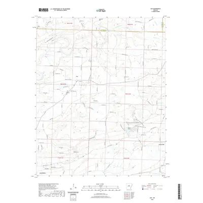
2020 Map of Guy
USGS Topo · Published 2020About this map
Guy sits at the center of this rural Arkansas landscape, where the headwaters of Cadron Creek and several of its tributaries, including Stillhouse Br and Wolf Br, carve through the undulating terrain of the foothills. This 2020 record illustrates a region defined by dispersed family-named settlements and essential community sites, such as the numerous burial grounds like Holland Cem and McNew Cem that serve as vital touchstones for local genealogy. The map details a transition from the higher elevations of Batesville Mtn in the north toward the distinct geological formation known as The Narrows in the south near Soda Valley. Modern recreation and local infrastructure are well represented, from the Enders Fault Mountain Bike Trail in Wooley Hollow to the private landing strip at Rak Airport, showcasing how the land between Greenbrier and Centerville continues to be utilized for both traditional agriculture and contemporary leisure.
Find a feature on this map
109 named features on this map. Tap any name to fly to it.
Don’t see what you’re looking for? This feature index may not catch every label — zoom into the map to look around manually.
Map Details
Editions of this 2020 Guy Map
This is the sole edition of this map. No revisions or reprints were ever made.
Other maps of this area

1956 · Russellville
USGS Topo · 1:250,000

1961 · Conway
USGS Topo · 1:62,500

1961 · Bee Branch
USGS Topo · 1:62,500

1961 · Greenbrier
USGS Topo · 1:24,000

1961 · Bee Branch
USGS Topo · 1:24,000

1961 · Morganton
USGS Topo · 1:24,000

1961 · Damascus
USGS Topo · 1:24,000

1961 · Guy
USGS Topo · 1:24,000
1961 · Holland
USGS Topo · 1:24,000

1963 · Quitman
USGS Topo · 1:24,000