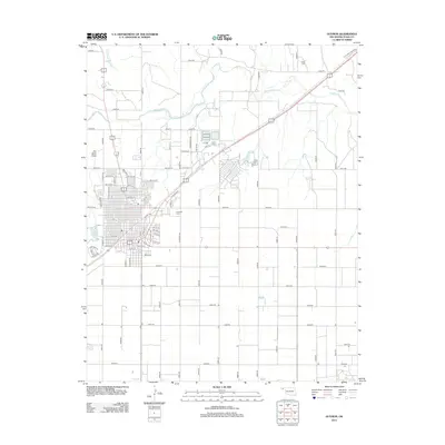
2012 Map of Guymon
USGS Topo · Published 2012About this map
The Beaver River winds through the northern plains of the Oklahoma Panhandle, providing a stark geographic contrast to the grid-patterned growth of the regional center. This 2012 survey shows the convergence of the C RI and P Railroad with major thoroughfares like Maple Ave and Patricia Blvd, reflecting a century of transportation-driven development. Local history is anchored by Elmhurst Cem on the town's eastern edge and the more remote Carter Cem to the northeast. The landscape transitions from the residential blocks near Sunset Lake to the arid drainage features of Dry Sand Draw and Three Seeds Draw. The extensive county road system, including e0180 RD and e0210 RD, illustrates the systematic division of land typical of the High Plains.
Find a feature on this map
79 named features on this map. Tap any name to fly to it.
Don’t see what you’re looking for? This feature index may not catch every label — zoom into the map to look around manually.
Map Details
Editions of this 2012 Guymon Map
This is the sole edition of this map. No revisions or reprints were ever made.
Other maps of this area

1954 · Perryton
USGS Topo · 1:250,000

1958 · Perryton
USGS Topo · 1:250,000

1967 · Straight SW
USGS Topo · 1:24,000

1967 · Optima
USGS Topo · 1:24,000

1968 · Guymon
USGS Topo · 1:24,000

1968 · Guymon SW
USGS Topo · 1:24,000

1968 · Guymon NE
USGS Topo · 1:24,000

1968 · Guymon SE
USGS Topo · 1:24,000

1973 · Goodwell SE
USGS Topo · 1:24,000

1973 · Goodwell NE
USGS Topo · 1:24,000