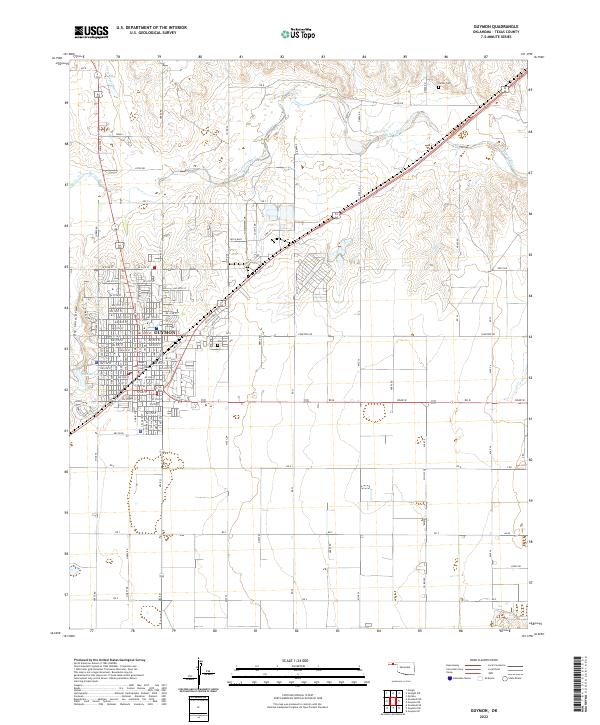
2022 Map of Guymon
USGS Topo · Published 2022About this map
Guymon serves as the regional hub of the Oklahoma Panhandle, where the city grid meets the expansive agricultural landscape of the High Plains. As the seat of Texas County Courthouse, the town's development is centered around its civic core and expanding residential blocks, including the areas near Elmhurst Cem and the waters of Sunset Lake. The surrounding terrain is defined by the winding course of the Beaver River, which cuts a distinct path through the northern sections of the map, while the Dry Sand Draw illustrates the semi-arid character of the local hydrology. This 2022 survey captures the contemporary footprint of the city, showing the established network of roads like Yucca Blvd and numerous numbered streets that support the area's role as a transportation and administrative center.
Find a feature on this map
72 named features on this map. Tap any name to fly to it.
Don’t see what you’re looking for? This feature index may not catch every label — zoom into the map to look around manually.
Map Details
Editions of this 2022 Guymon Map
This is the sole edition of this map. No revisions or reprints were ever made.
Other maps of this area

1954 · Perryton
USGS Topo · 1:250,000

1958 · Perryton
USGS Topo · 1:250,000

1967 · Straight SW
USGS Topo · 1:24,000

1967 · Optima
USGS Topo · 1:24,000

1968 · Guymon
USGS Topo · 1:24,000

1968 · Guymon SW
USGS Topo · 1:24,000

1968 · Guymon NE
USGS Topo · 1:24,000

1968 · Guymon SE
USGS Topo · 1:24,000

1973 · Goodwell SE
USGS Topo · 1:24,000

1973 · Goodwell NE
USGS Topo · 1:24,000