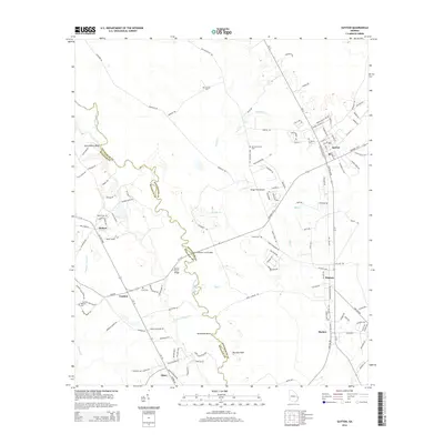
2014 Map of Guyton
USGS Topo · Published 2014About this map
The Ogeechee River snakes along the border of Effingham and Bulloch counties, defining the western edge of this coastal plain landscape. Small agricultural and residential communities like Guyton, Pineora, and Marlow are connected by a grid of local roads and the prominent Ga-17 corridor. Notable for genealogists and local historians, the area is dotted with family and community landmarks such as Newton Cem, Old Providence Cem, and Ferguson Cem. Infrastructure like the Briggs Field Airport and several historic river crossings, including the Captain William Cone Bridge and Doctor Floyd Bridge, reflect the local transportation history. From the elevations at Saint Peters Bluff to the wetlands of Boggy Bay and Shrimp Cr, this map provides a detailed view of the rural settlements and natural drainage patterns northwest of Savannah.
Find a feature on this map
129 named features on this map. Tap any name to fly to it.
Don’t see what you’re looking for? This feature index may not catch every label — zoom into the map to look around manually.
Map Details
Editions of this 2014 Guyton Map
This is the sole edition of this map. No revisions or reprints were ever made.
Other maps of this area

1919 · Egypt
USGS Topo · 1:62,500

1920 · Pembroke
USGS Topo · 1:62,500

1920 · Meldrim
USGS Topo · 1:62,500

1921 · Brooklet
USGS Topo · 1:62,500

1939 · Egypt
USGS Topo · 1:62,500

1942 · Meldrim
USGS Topo · 1:62,500

1943 · Brooklet
USGS Topo · 1:62,500

1943 · Egypt
USGS Topo · 1:62,500

1947 · Savannah
USGS Topo · 1:250,000

1948 · Savannah
USGS Topo · 1:250,000