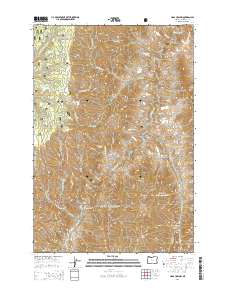
2014 Map of Haas Hollow
USGS Topo · Published 2014About this map
Imnaha River drainage and the surrounding mountain ridges define this 2014 survey of the Wallowa National Forest. The geography is marked by a complex system of watercourses and canyons, including Pileup Canyon and Crooked Canyon in the southeastern quadrant. Higher elevations are anchored by prominent landmarks such as Grizzly Ridge and Haas Ridge, while the namesake Haas Hollow sits below the ridge line. Human presence is largely represented by a network of forest roads and trails, including Rimrock Rd, Lower Imnaha Rd, and Fence Line Creek Rd. The abundance of named springs and creek forks, such as Pucksaddle Spring and S Fork Chesnimnus Cr, highlights the vital hydrology of this high-elevation landscape within Wallowa County.
Find a feature on this map
36 named features on this map. Tap any name to fly to it.
Don’t see what you’re looking for? This feature index may not catch every label — zoom into the map to look around manually.
Map Details
Editions of this 2014 Haas Hollow Map
This is the sole edition of this map. No revisions or reprints were ever made.
Other maps of this area

1954 · Imnaha
USGS Topo · 1:62,500

1954 · Kernan Point
USGS Topo · 1:62,500

1955 · Grangeville
USGS Topo · 1:250,000

1959 · Grangeville
USGS Topo · 1:250,000

1963 · Cactus Mtn
USGS Topo · 1:24,000

1963 · Deadhorse Ridge
USGS Topo · 1:24,000

1963 · Poison Point
USGS Topo · 1:24,000

1980 · Grangeville
USGS Topo · 1:100,000

1990 · Imnaha
USGS Topo · 1:24,000
1990 · Sleepy Ridge
USGS Topo · 1:24,000