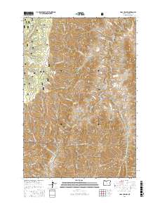
2017 Map of Haas Hollow
USGS Topo · Published 2017About this map
The Imnaha River carves a deep path through this corner of the Wallowa National Forest, defining a landscape where steep canyon walls meet high plateaus. This 2017 survey details a network of canyons and gulches, including Pileup Canyon, Crooked Canyon, and Knapper Gulch, which drain toward the river from the high country of Grizzly Ridge. The map illustrates the specialized infrastructure required for this isolated terrain, such as the Power Line Rd and the vital Dug Bar Rd which provides access to the river's lower reaches.
Find a feature on this map
38 named features on this map. Tap any name to fly to it.
Don’t see what you’re looking for? This feature index may not catch every label — zoom into the map to look around manually.
Map Details
Editions of this 2017 Haas Hollow Map
This is the sole edition of this map. No revisions or reprints were ever made.
Other maps of this area

1954 · Imnaha
USGS Topo · 1:62,500

1954 · Kernan Point
USGS Topo · 1:62,500

1955 · Grangeville
USGS Topo · 1:250,000

1959 · Grangeville
USGS Topo · 1:250,000

1963 · Cactus Mtn
USGS Topo · 1:24,000

1963 · Deadhorse Ridge
USGS Topo · 1:24,000

1963 · Poison Point
USGS Topo · 1:24,000

1980 · Grangeville
USGS Topo · 1:100,000

1990 · Imnaha
USGS Topo · 1:24,000
1990 · Sleepy Ridge
USGS Topo · 1:24,000