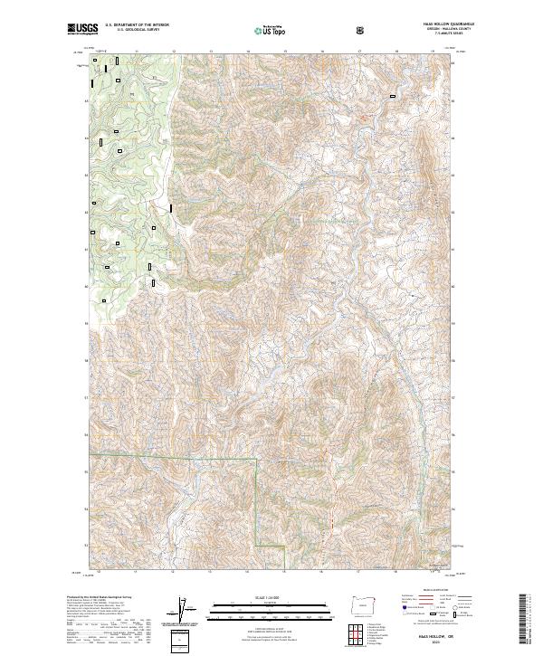
2023 Map of Haas Hollow
USGS Topo · Published 2023About this map
The Imnaha Wild and Scenic River carves a central corridor through this portion of the Wallowa National Forest. This protected riparian landscape is defined by deep drainages and high divides, notably Haas Ridge and Grizzly Ridge, which separate the myriad tributary creeks feeding the primary river system. Historical access and movement across this uneven terrain are marked by an established network of paths, including the Thorn Creek Trl, Corral Creek Trl, and Grizzly Ridge Trl.
Find a feature on this map
45 named features on this map. Tap any name to fly to it.
Don’t see what you’re looking for? This feature index may not catch every label — zoom into the map to look around manually.
Map Details
Editions of this 2023 Haas Hollow Map
This is the sole edition of this map. No revisions or reprints were ever made.
Other maps of this area

1954 · Imnaha
USGS Topo · 1:62,500

1954 · Kernan Point
USGS Topo · 1:62,500

1955 · Grangeville
USGS Topo · 1:250,000

1959 · Grangeville
USGS Topo · 1:250,000

1963 · Cactus Mtn
USGS Topo · 1:24,000

1963 · Deadhorse Ridge
USGS Topo · 1:24,000

1963 · Poison Point
USGS Topo · 1:24,000

1980 · Grangeville
USGS Topo · 1:100,000

1990 · Imnaha
USGS Topo · 1:24,000
1990 · Sleepy Ridge
USGS Topo · 1:24,000