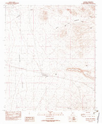
1982 Map of Hachita
USGS Topo · Published 1983About this map
Hachita serves as the central point of this southwestern landscape, situated where the broad Hachita Valley meets the high ground of the Continental Divide. The settlement’s history is etched into the terrain through a series of linear markers, including an Old Grade and an RR Grade that trace the former paths of industry and transport through the basin. Near the town site, a local Cem and a Gravel Pit offer specific points of interest for genealogists and industrial historians.
Find a feature on this map
16 named features on this map. Tap any name to fly to it.
Don’t see what you’re looking for? This feature index may not catch every label — zoom into the map to look around manually.
Map Details
Editions of this 1982 Hachita Map
2 editions found
Other maps of this area

1918 · Hachita
USGS Topo · 1:62,500

1918 · Victorio
USGS Topo · 1:62,500

1954 · Silver City
USGS Topo · 1:250,000

1955 · Douglas
USGS Topo · 1:250,000

1958 · Silver City
USGS Topo · 1:250,000

1959 · Douglas
USGS Topo · 1:250,000

1961 · Douglas
USGS Topo · 1:250,000

1962 · Silver City
USGS Topo · 1:250,000

1963 · Gage SW
USGS Topo · 1:24,000

1964 · Douglas
USGS Topo · 1:250,000