
1952 Map of Hackamore
USGS Topo · Published 1954About this map
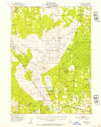
The Southern Pacific railroad creates a vital artery through this section of the Modoc National Forest in the early 1950s, connecting small rail stops like Meares, Hackamore, and Boles. This landscape is defined by its volcanic geology and water management, featuring a dense network of specialized infrastructure such as the Pumice Brick Plant and a Plant Quarantine Station. Numerous reservoirs and wells, including Whitney and Beeler Reservoir, appear alongside natural features like Damons Cave and Lone Pine Butte. The presence of industrial and agricultural markers, such as the Stovepipe Flat Tank and Sorholus Tank, reflects the utilitarian nature of the territory during this period of California's history. Timber and transit converge here, with named routes like Tickner Road and Boles Road providing access to high-elevation landmarks such as Knobcone Butte and Spaulding Butte.
Find a feature on this map
45 named features on this map. Tap any name to fly to it.
Don’t see what you’re looking for? This feature index may not catch every label — zoom into the map to look around manually.
Map Details
Editions of this 1952 Hackamore Map
4 editions found
Other maps of this area

1886 · Alturas
USGS Topo · 1:250,000

1886 · Modoc Lava Bed
USGS Topo · 1:250,000

1892 · Modoc Lava-Bed
USGS Topo · 1:250,000

1892 · Alturas
USGS Topo · 1:250,000

1951 · Clear Lake Reservoir
USGS Topo · 1:62,500

1951 · Tulelake
USGS Topo · 1:62,500

1952 · Timber Mountain
USGS Topo · 1:62,500

1954 · Alturas
USGS Topo · 1:250,000

1958 · Alturas
USGS Topo · 1:250,000

1961 · Canby
USGS Topo · 1:62,500