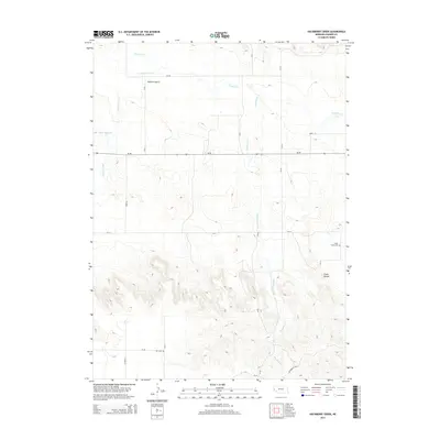
2014 Map of Hackberry Creek
USGS Topo · Published 2014About this map
Pumpkin Creek and its southern tributaries define the topography of this Banner County landscape, where the flat agricultural plains of the north give way to the dissected ridges and bluffs of the Wildcat Hills. The map captures a transition from the drainage of Bighorn Gulch and Muhr Reservoir into more varied terrain near the prominent elevation of Chalk Mound. Transportation follows a strict section-line grid across the open country, centered on the east-west corridor of Ne-88. For local history researchers, the map identifies two distinct burial sites: Chalk Creek Cemetery near the eastern edge and Kirk Cemetery to the southwest. These markers, along with the meandering path of Hackberry Creek, provide essential landmarks for tracing family landholdings and early settlement patterns in this high plains environment.
Find a feature on this map
25 named features on this map. Tap any name to fly to it.
Don’t see what you’re looking for? This feature index may not catch every label — zoom into the map to look around manually.
Map Details
Editions of this 2014 Hackberry Creek Map
This is the sole edition of this map. No revisions or reprints were ever made.
Other maps of this area

1898 · Scotts Bluff
USGS Topo · 1:125,000

1898 · Camp Clarke
USGS Topo · 1:125,000

1954 · Scottsbluff
USGS Topo · 1:250,000

1958 · Scottsbluff
USGS Topo · 1:250,000

1965 · South Bayard
USGS Topo · 1:24,000

1965 · McGrew
USGS Topo · 1:24,000

1973 · Scotts Bluff 4 SE
USGS Topo · 1:24,000

1973 · Scotts Bluff 4 NE
USGS Topo · 1:24,000

1973 · Kimball 1 NE
USGS Topo · 1:24,000

1973 · Potter 2 NW
USGS Topo · 1:24,000