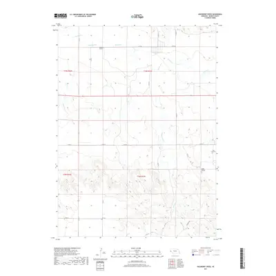
2017 Map of Hackberry Creek
USGS Topo · Published 2017About this map
Pumpkin Cr and its associated drainages define the northern landscape of this Banner County region, where the high plains meet the intricate topography of the Nebraska Panhandle. The map reveals a rural environment structured by a grid of county roads and section lines, including Co RD 24 and Co RD 14. In the southeastern corner, the land rises toward Chalk Mound, a distinct topographical landmark. Genealogists and local historians will find significant interest in the presence of Chalk Creek Cem and Kirk Cem, which serve as physical anchors for the area's pioneer families and early settlement history. The intermittent flow of Hackberry Creek and Bighorn Gulch through the draws illustrates the drainage patterns essential to the ranching and agricultural life that has long characterized this portion of the state.
Find a feature on this map
25 named features on this map. Tap any name to fly to it.
Don’t see what you’re looking for? This feature index may not catch every label — zoom into the map to look around manually.
Map Details
Editions of this 2017 Hackberry Creek Map
This is the sole edition of this map. No revisions or reprints were ever made.
Other maps of this area

1898 · Scotts Bluff
USGS Topo · 1:125,000

1898 · Camp Clarke
USGS Topo · 1:125,000

1954 · Scottsbluff
USGS Topo · 1:250,000

1958 · Scottsbluff
USGS Topo · 1:250,000

1965 · South Bayard
USGS Topo · 1:24,000

1965 · McGrew
USGS Topo · 1:24,000

1973 · Scotts Bluff 4 SE
USGS Topo · 1:24,000

1973 · Scotts Bluff 4 NE
USGS Topo · 1:24,000

1973 · Kimball 1 NE
USGS Topo · 1:24,000

1973 · Potter 2 NW
USGS Topo · 1:24,000