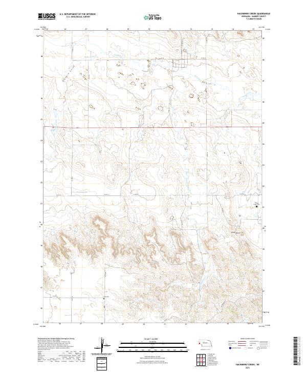
2021 Map of Hackberry Creek
USGS Topo · Published 2021About this map
Pumpkin Cr and Hackberry Creek meander through the prairie landscape of Banner County, Nebraska, in this 2021 topographic record. The map reveals a sparsely populated ranching region defined by a grid of county roads, such as Co RD 63 and Co RD 24, which navigate the elevation changes between the creek beds and upland terrain. Notable landmarks for local history researchers include Chalk Mound and two distinct burial grounds: Chalk Creek Cem in the northeast and Kirk Cem to the southwest.
Find a feature on this map
23 named features on this map. Tap any name to fly to it.
Don’t see what you’re looking for? This feature index may not catch every label — zoom into the map to look around manually.
Map Details
Editions of this 2021 Hackberry Creek Map
This is the sole edition of this map. No revisions or reprints were ever made.
Other maps of this area

1898 · Scotts Bluff
USGS Topo · 1:125,000

1898 · Camp Clarke
USGS Topo · 1:125,000

1954 · Scottsbluff
USGS Topo · 1:250,000

1958 · Scottsbluff
USGS Topo · 1:250,000

1965 · South Bayard
USGS Topo · 1:24,000

1965 · McGrew
USGS Topo · 1:24,000

1973 · Scotts Bluff 4 SE
USGS Topo · 1:24,000

1973 · Scotts Bluff 4 NE
USGS Topo · 1:24,000

1973 · Kimball 1 NE
USGS Topo · 1:24,000

1973 · Potter 2 NW
USGS Topo · 1:24,000