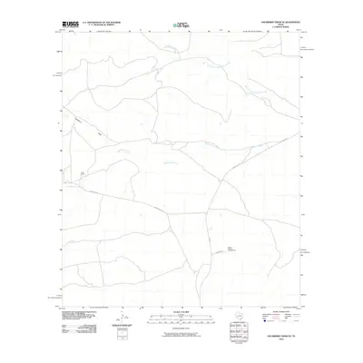
2010 Map of Hackberry Draw SE
USGS Topo · Published 2010About this map
Independence Creek and its tributary, North Fork Independence Creek, define the drainage patterns of this Pecos County landscape. The area is characterized by large-scale ranching operations, most notably the Porter Ranch in the west and the Abilene Christian College Ranch to the southeast. These holdings reflect the region's long-standing reliance on extensive land tracts for livestock. Transportation across this arid terrain is facilitated by a network of rural routes including Gray Ranch Rd, Edwards Rd, and Ranch Rd 2886. The topographic detail also highlights Hackberry Draw, a significant seasonal watercourse that cuts through the northern portion of the quadrangle.
Find a feature on this map
9 named features on this map. Tap any name to fly to it.
Don’t see what you’re looking for? This feature index may not catch every label — zoom into the map to look around manually.
Map Details
Editions of this 2010 Hackberry Draw SE Map
This is the sole edition of this map. No revisions or reprints were ever made.
Other maps of this area

1928 · Sanderson
USGS Topo · 1:125,000

1929 · Independence Draw Quadrangle
USGS Topo · 1:125,000

1954 · Fort Stockton
USGS Topo · 1:250,000

1958 · Fort Stockton
USGS Topo · 1:250,000

1969 · Circle Dot Ranch
USGS Topo · 1:24,000

1969 · Big Canyon Ranch NW
USGS Topo · 1:24,000
1969 · Seventeen Ranch
USGS Topo · 1:24,000

1969 · Hackberry Draw NW
USGS Topo · 1:24,000

1969 · Hackberry Draw NE
USGS Topo · 1:24,000
1969 · Hackberry Draw SE
USGS Topo · 1:24,000