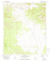
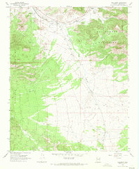
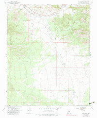
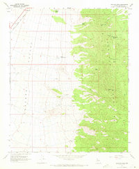
1968 Map of Hackberry
USGS Topo · Published 1986About this map
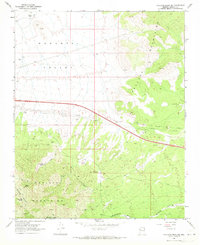
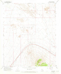
Hackberry and Truxton sit at the northern edge of this high-desert landscape, positioned along the vital transportation corridor of the Atchison Topeka and Santa Fe railroad. The topography is dominated by the massive rise of the Cottonwood Mountains to the east and the Peacock Mountains to the west, separated by the wide drainage of Hackberry Wash. This 1968 survey reveals a landscape defined by ranching and transit, featuring a Landing Strip and various water tanks essential for life in the arid Mohave County interior. The presence of Valentine (Siding) further illustrates the importance of the rail line to the local economy. Beyond the main settlements, the map documents numerous prospects and a Jeep Trail winding through the foothills, indicating a history of mineral exploration and rugged access throughout the canyons and alluvial fans.
Find a feature on this map
14 named features on this map. Tap any name to fly to it.
Don’t see what you’re looking for? This feature index may not catch every label — zoom into the map to look around manually.
Map Details
Editions of this 1968 Hackberry Map
3 editions found
Other maps of this area

1886 · Diamond Creek
USGS Topo · 1:250,000

1892 · Diamond Creek
USGS Topo · 1:250,000

1948 · Williams
USGS Topo · 1:250,000

1954 · Williams
USGS Topo · 1:250,000

1956 · Williams
USGS Topo · 1:250,000

1960 · Williams
USGS Topo · 1:250,000

1961 · Williams
USGS Topo · 1:250,000
1968 · Peacock Peak
USGS Topo · 1:24,000
1968 · Hualapai Peak NE
USGS Topo · 1:24,000
1968 · Antares
USGS Topo · 1:24,000