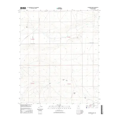
2017 Map of Hackberry Ranch
USGS Topo · Published 2017About this map
Hackberry Ranch serves as the namesake of this Chaves County landscape, situated amidst a network of ephemeral watercourses and ranching roads. The terrain is defined by its drainage patterns, with Rio Felix and Walnut Cr cutting across the land, supported by numerous named features such as Antelope Draw, Loin Draw, and Made Draw. This modern survey reveals how the land is partitioned for agricultural and transportation use, with a series of rural corridors like Sagebrush Valley Rd and Old Y O Crossing Rd connecting isolated properties. The inclusion of the Champion Ranch Airport highlights the necessity of private aviation for navigating and managing these expansive New Mexico ranchlands, while the intricate contour lines illustrate the subtle topographic shifts characteristic of this high plains environment.
Find a feature on this map
19 named features on this map. Tap any name to fly to it.
Don’t see what you’re looking for? This feature index may not catch every label — zoom into the map to look around manually.
Map Details
Editions of this 2017 Hackberry Ranch Map
This is the sole edition of this map. No revisions or reprints were ever made.
Other maps of this area

1949 · Peters Lake
USGS Topo · 1:24,000

1949 · Juan Lake
USGS Topo · 1:24,000

1950 · Dexter West
USGS Topo · 1:24,000

1952 · Hagerman SW
USGS Topo · 1:24,000

1953 · Espuela
USGS Topo · 1:24,000

1954 · Carlsbad
USGS Topo · 1:250,000

1955 · Hope NW
USGS Topo · 1:24,000

1955 · Hackberry Ranch
USGS Topo · 1:24,000

1955 · Kincaid Ranch
USGS Topo · 1:24,000

1955 · Hope NE
USGS Topo · 1:24,000