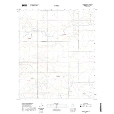
2023 Map of Hackberry Ranch
USGS Topo · Published 2023About this map
Rio Felix and Walnut Creek define the drainage patterns of this Chaves County ranching landscape, where ephemeral watercourses like Antelope Draw and Loin Draw carve through the high plains. The map illustrates a contemporary era of remote land management, anchored by the Champion Ranch Airport in the southeastern quadrant. This specialized aviation hub serves as a critical point of access for the surrounding rural territory. An established grid of local transit routes, including Sagebrush Valley Rd and Old Y O Crossing Rd, connects the scattered ranch holdings. The persistence of names like Made Draw and Walnut Draw reflects a long history of seasonal water reliance in an environment defined by its dry-creek topography and vast township-and-range divisions.
Find a feature on this map
18 named features on this map. Tap any name to fly to it.
Don’t see what you’re looking for? This feature index may not catch every label — zoom into the map to look around manually.
Map Details
Editions of this 2023 Hackberry Ranch Map
This is the sole edition of this map. No revisions or reprints were ever made.
Other maps of this area

1949 · Peters Lake
USGS Topo · 1:24,000

1949 · Juan Lake
USGS Topo · 1:24,000

1950 · Dexter West
USGS Topo · 1:24,000

1952 · Hagerman SW
USGS Topo · 1:24,000

1953 · Espuela
USGS Topo · 1:24,000

1954 · Carlsbad
USGS Topo · 1:250,000

1955 · Hope NW
USGS Topo · 1:24,000

1955 · Hackberry Ranch
USGS Topo · 1:24,000

1955 · Kincaid Ranch
USGS Topo · 1:24,000

1955 · Hope NE
USGS Topo · 1:24,000