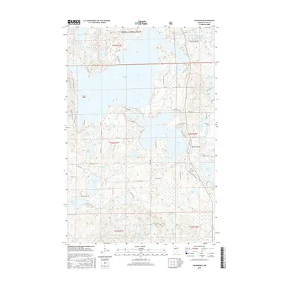
2016 Map of Hackensack
USGS Topo · Published 2016About this map
The town of Hackensack serves as the focal point for this region of Cass County, where the sprawling waters of Tenmile Lake and Birch Lake dominate the landscape. This area, largely contained within the Chippewa National Forest, is defined by its complex glacial hydrology, featuring dozens of named water bodies from the small Scoffner Lake to the significant Boy River drainage. The map reveals a transition between dense forest cover and established lakeside communities, with landmarks like Angel Island and the Woodtick Number One Impoundment illustrating human management of the regional watershed.
Find a feature on this map
77 named features on this map. Tap any name to fly to it.
Don’t see what you’re looking for? This feature index may not catch every label — zoom into the map to look around manually.
Map Details
Editions of this 2016 Hackensack Map
This is the sole edition of this map. No revisions or reprints were ever made.
Other maps of this area

1953 · Brainerd
USGS Topo · 1:250,000

1954 · Bemidji
USGS Topo · 1:250,000

1957 · Brainerd
USGS Topo · 1:250,000

1957 · Bemidji
USGS Topo · 1:250,000

1958 · Bemidji
USGS Topo · 1:250,000

1958 · Brainerd
USGS Topo · 1:250,000

1965 · Brainerd
USGS Topo · 1:250,000

1970 · Backus
USGS Topo · 1:24,000

1970 · Hackensack
USGS Topo · 1:24,000
1970 · Mildred
USGS Topo · 1:24,000