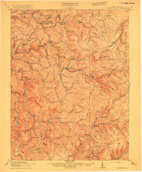
1915 Map of Hacker Valley
USGS Topo · Published 1915About this map
The Lumber RR snakes through the high ridges and deep forks of this 1913 survey, following the Holly and Kanawha River to tap the timber of the central West Virginia highlands. The landscape is defined by its rural isolation and industrial logistics, where the Salisbury Sta Removal P.O. and Arvondale Junc suggest a period of transition in local communication and transport. A dense network of one-room schoolhouses, including Saffles Retreat School, Snuffville School, and Windy Gap School, serves scattered settlements like Hacker Valley and Cleveland. The terrain is marked by prominent landmarks such as Hodam Mountain and Potato Knob, with the Back Fork and Right Fork carving out the deep hollows that dictated the placement of small mountain communities.
Find a feature on this map
131 named features on this map. Tap any name to fly to it.
Don’t see what you’re looking for? This feature index may not catch every label — zoom into the map to look around manually.
Map Details
Editions of this 1915 Hacker Valley Map
4 editions found

Other maps of this area

1889 · Nicholas
USGS Topo · 1:125,000

1891 · Nicholas
USGS Topo · 1:125,000

1891 · Huntersville
USGS Topo · 1:125,000

1893 · Buckhannon
USGS Topo · 1:125,000

1893 · Sutton
USGS Topo · 1:125,000

1894 · Huntersville
USGS Topo · 1:125,000

1896 · Buckhannon
USGS Topo · 1:125,000

1897 · Buckhannon
USGS Topo · 1:125,000

1901 · Nicholas
USGS Topo · 1:125,000

1906 · Burnsville
USGS Topo · 1:62,500