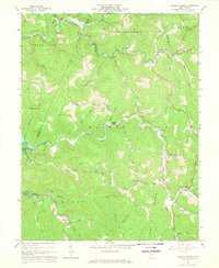
1967 Map of Hacker Valley
USGS Topo · Published 1968About this map
The Little Kanawha River and the Holly River carve through the steep topography of the Allegheny Plateau in this late 1960s survey. This map documents a series of small mountain communities like Hacker Valley, Cleveland, and Replete connected by winding roads and several jeep trails. Local religious and community centers are clearly identified, including the Chestnut Grove Ch, Panther Lick Ch, and Hacker Valley Ch.
Find a feature on this map
59 named features on this map. Tap any name to fly to it.
Don’t see what you’re looking for? This feature index may not catch every label — zoom into the map to look around manually.
Map Details
Editions of this 1967 Hacker Valley Map
2 editions found
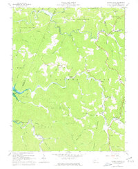
Other maps of this area

1893 · Buckhannon
USGS Topo · 1:125,000

1893 · Sutton
USGS Topo · 1:125,000

1896 · Buckhannon
USGS Topo · 1:125,000

1897 · Buckhannon
USGS Topo · 1:125,000

1906 · Burnsville
USGS Topo · 1:62,500

1908 · Sutton
USGS Topo · 1:48,000

1910 · Sutton Special
USGS Topo · 1:62,500

1912 · Crawford
USGS Topo · 1:48,000

1913 · Hacker Valley
USGS Topo · 1:48,000

1914 · Crawford
USGS Topo · 1:62,500