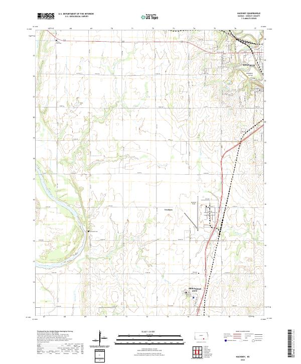
2022 Map of Hackney
USGS Topo · Published 2022About this map
Strother Field occupies a central position on this Cowley County landscape, situated between the urban developments of Winfield and Arkansas City. The map documents a corridor defined by the Arkansas River and the Walnut River, where the prairie gives way to several named drainages including Beaver Creek and Spring Creek. The agricultural character of the region is punctuated by numerous family and community landmarks, such as Tannehill Cemetery and Mount Zion Cemetery. A distinctive local landmark, the Kickapoo Corral, appears near the eastern edge along Tunnel Mill Road, highlighting the intersection of local history and rural infrastructure. The mapping detail includes a dense network of township roads, such as 51st Road and 222nd Road, which delineate the section-line grids characteristic of this part of Kansas.
Find a feature on this map
76 named features on this map. Tap any name to fly to it.
Don’t see what you’re looking for? This feature index may not catch every label — zoom into the map to look around manually.
Map Details
Editions of this 2022 Hackney Map
This is the sole edition of this map. No revisions or reprints were ever made.
Other maps of this area

1889 · Burden
USGS Topo · 1:125,000

1890 · Wellington
USGS Topo · 1:125,000

1955 · Wichita
USGS Topo · 1:250,000

1958 · Wichita
USGS Topo · 1:250,000

1965 · Silverdale
USGS Topo · 1:24,000

1965 · Arkansas City
USGS Topo · 1:24,000

1965 · Adamsville
USGS Topo · 1:24,000

1965 · Geuda Springs
USGS Topo · 1:24,000

1965 · Winfield
USGS Topo · 1:24,000
1965 · New Salem
USGS Topo · 1:24,000