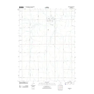
2012 Map of Haddam
USGS Topo · Published 2012About this map
Haddam serves as the primary hub in this portion of Washington County, defined by a rigid grid of rural roads and the meandering paths of local waterways. The town center is organized around Main St and Taylor St, featuring a local Post Office and the Haddam Community Golf Course on its southern edge. This agricultural landscape is drained by a dense network of tributaries, including Mill Cr, Mulberry Cr, and Turkey Cr, which break the geometric precision of the section lines. Local history is anchored by the Haddam Cem and the more isolated Oliver Cem to the west. Outside the main township, the map identifies Hay Valley, while a systematic network of routes like Arrowhead Rd and 20th Rd facilitates movement across the rolling prairie terrain, reflecting the long-standing Kansas township and range survey system.
Find a feature on this map
46 named features on this map. Tap any name to fly to it.
Don’t see what you’re looking for? This feature index may not catch every label — zoom into the map to look around manually.
Map Details
Editions of this 2012 Haddam Map
This is the sole edition of this map. No revisions or reprints were ever made.
Other maps of this area

1893 · Washington
USGS Topo · 1:125,000

1955 · Manhattan
USGS Topo · 1:250,000

1956 · Manhattan
USGS Topo · 1:250,000

1957 · Manhattan
USGS Topo · 1:250,000

1965 · Brantford
USGS Topo · 1:24,000

1965 · Agenda
USGS Topo · 1:24,000
1966 · Washington NW
USGS Topo · 1:24,000

1966 · Morrowville
USGS Topo · 1:24,000
1966 · Narka
USGS Topo · 1:24,000
1966 · Haddam
USGS Topo · 1:24,000