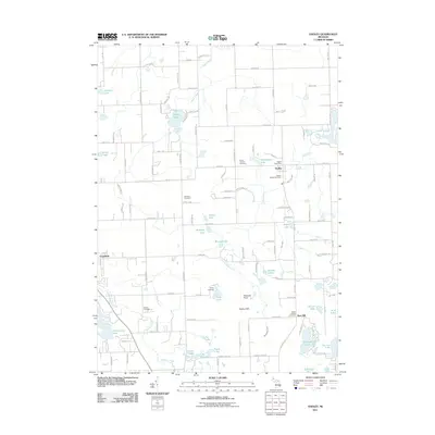
2011 Map of Hadley
USGS Topo · Published 2011About this map
The settlement of Hadley and the rural hills of Lapeer County define this landscape, where early community sites remain well-preserved in the modern topography. Genealogists will find several distinct burial grounds, including the Hadley Village Cemetery, Green Corners Cemetery, and Sanborn Cemetery, which anchor the historical record of local families. The terrain transitions from the elevations of the Hadley Hills and Pinnacle Point in the south to a dense concentration of glacial water bodies in the north, such as Lake Lapeer and Hasley Lake. This hydrography is further characterized by the winding paths of Mill Creek and Kearsley Creek, which likely dictated early land use and settlement patterns. To the west, the village of Goodrich sits along the edge of this transition, while landmarks like the Hadley Post Office and Camp Lakeview near Tody Lake mark the enduring centers of community life in this part of Michigan.
Find a feature on this map
112 named features on this map. Tap any name to fly to it.
Don’t see what you’re looking for? This feature index may not catch every label — zoom into the map to look around manually.
Map Details
Editions of this 2011 Hadley Map
This is the sole edition of this map. No revisions or reprints were ever made.
Other maps of this area

1920 · Flint
USGS Topo · 1:62,500

1920 · Holly
USGS Topo · 1:62,500

1922 · Holly
USGS Topo · 1:62,500

1922 · Flint
USGS Topo · 1:62,500

1943 · Holly
USGS Topo · 1:62,500

1943 · Flint
USGS Topo · 1:62,500

1943 · Ortonville
USGS Topo · 1:24,000

1943 · Oxford
USGS Topo · 1:24,000

1943 · Metamora
USGS Topo · 1:24,000

1945 · Oxford
USGS Topo · 1:24,000